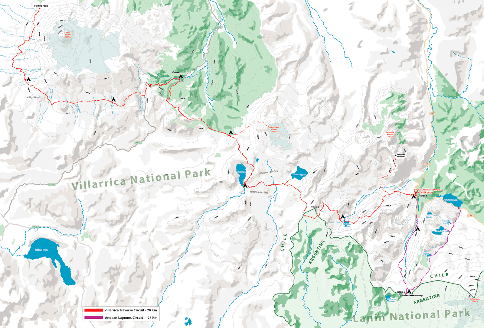
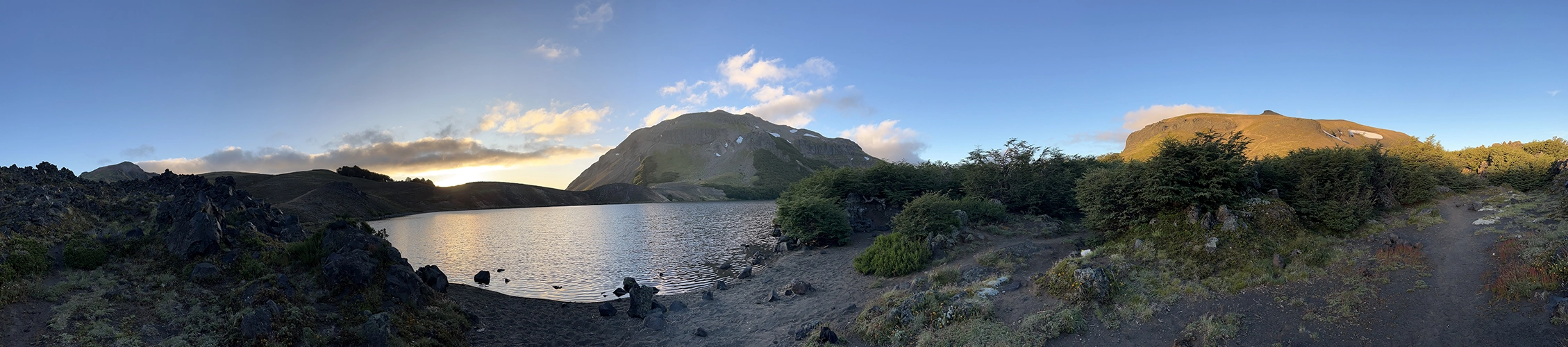
Villarrica Traverse landscape

The Route & Map

Discover the trail that links three volcanoes through forests, lava fields and high Andean terrain.

Route & map

Tracing the Traverse

A topographic view of the expedition — tracing the route that links Villarrica, Quetrupillán and Lanín across forests, lava fields and exposed volcanic ground.

More than an orientation tool, the map reveals the overall logic of the route: how each stage relates to the broader landscape, how the terrain opens and changes, and how the traverse advances through one of the most dramatic volcanic regions in the southern Andes.

Interactive expedition map Three volcanoes / one continuous traverse
The traverse unfolds through a remote volcanic corridor shaped by native forest, black lava flows, open plateaus and the long horizon of the Andean frontier.
Field notes

Route Notes

An insight into the traverse — how the terrain behaves, how the journey unfolds, and what defines movement across this remote volcanic landscape.

01

Volcanic Terrain

The traverse moves through a landscape shaped by successive eruptions, glacial exposure and native forest. Black lava fields, ash slopes, hardened escorial and open high ground create a constantly changing rhythm underfoot, requiring attention, balance and steady pacing.

Lava fields Ash slopes Alpine exposure
02

Remote Progression

This is not a route of quick access or easy crossings. Each stage pushes deeper into a vast volcanic corridor where distance, weather and terrain set the rhythm of the journey. With every section, the scale of the landscape expands, transforming the traverse into a true expedition rather than a series of isolated hikes.

Multi-day rhythm Long transitions Expedition logic
03

Navigation Support

While the map defines the route, safe passage through the traverse depends on informed decisions in the field. GPS support, route intelligence, weather alerts and communication systems play a vital role in terrain where conditions evolve quickly and distances can be deceptive. Through Patagonia Experience, the traverse is backed by the safety systems and operational support needed for remote mountain travel.

GPS guidance Route alerts Safety support
Cartographic sheet

Detailed Route Map

A high-resolution topographic map of the Villarrica Traverse — designed for reading the terrain in detail, from elevation profiles to route precision.

This map was developed as part of the expedition planning process, combining terrain data, altitude references and route tracing into a single visual sheet. It is available for download and can be explored at full scale.

Villarrica Traverse topographic map

A high-resolution version of the Villarrica Traverse expedition map is available on request. Write to us and we will guide you through the next steps.

Request high-resolution map High resolution · Print-ready · Detailed topography · Available on request